In the world of Geographic Information Systems (GIS), 2024 has brought forth a plethora of cutting-edge software options that cater to a wide range of needs and preferences. Whether you’re a seasoned GIS professional or just starting out, there’s something for everyone in this dynamic field. Here, we’ve compiled a list of the top 7 GIS software of 2024, based on their features, functionality, and user feedback.
- ArcGIS Pro: Developed by Esri, ArcGIS Pro continues to be a dominant player in the GIS software market. It offers advanced mapping and analysis tools, 3D visualization capabilities, and seamless integration with other Esri products. ArcGIS Pro’s user-friendly interface and robust features make it a top choice for GIS professionals worldwide.
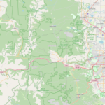
- QGIS: An open-source GIS software, QGIS has gained popularity for its flexibility and extensibility. It offers a wide range of features, including mapping, spatial analysis, and data editing. QGIS also has a vibrant community of users and developers who contribute to its ongoing development and improvement.
- MapInfo Pro: Developed by Pitney Bowes, MapInfo Pro is a powerful GIS software known for its advanced mapping and spatial analysis capabilities. It offers a user-friendly interface, support for a wide range of data formats, and integration with other business systems. MapInfo Pro is widely used in industries such as retail, transportation, and government.
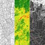
- Google Earth Pro: Google Earth Pro is a popular GIS software that offers high-resolution satellite imagery, 3D terrain models, and advanced mapping tools. It is widely used for visualizing geographic data, conducting virtual tours, and creating custom maps. Google Earth Pro is available for both desktop and mobile devices, making it accessible to a wide range of users.
- GRASS GIS: Another open-source GIS software, GRASS GIS is known for its powerful analysis tools and extensive geospatial libraries. It offers support for a wide range of data formats, including raster, vector, and point clouds. GRASS GIS is widely used in academia, research, and environmental modeling.
- Global Mapper: Global Mapper is a comprehensive GIS software that offers a wide range of features, including mapping, spatial analysis, and 3D visualization. It is known for its user-friendly interface and support for a wide range of data formats. Global Mapper is used in industries such as forestry, mining, and urban planning.
- Carto: Formerly known as CartoDB, Carto is a cloud-based GIS software that offers advanced mapping and analysis tools. It is known for its ease of use and scalability, making it a popular choice for businesses and organizations of all sizes. Carto offers a range of pricing plans, including a free tier for small-scale projects.
In conclusion, the GIS software landscape of 2024 offers a diverse range of options to suit every need and budget. Whether you’re looking for advanced analysis tools, user-friendly interfaces, or cloud-based solutions, there’s something for everyone in this dynamic field. The key is to evaluate your specific requirements and choose the software that best meets your needs.