
Geographic Information Systems (GIS) have become an integral part of modern-day spatial data analysis and visualization. GIS data formats play a crucial role in storing, managing, and exchanging geographical information. Understanding the different GIS data formats is essential for anyone working with spatial data. Here, we explore the top seven GIS data formats you should know about.
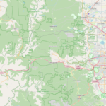
- Shapefile (SHP): Developed by Esri, the shapefile is one of the most widely used GIS data formats. It consists of a collection of files with different extensions (.shp, .shx, .dbf) that store geometric and attribute data. Despite its age and limitations, the shapefile remains popular due to its simplicity and compatibility with many GIS software.
- GeoJSON: GeoJSON is a lightweight format for encoding geographical data structures. It is based on JavaScript Object Notation (JSON) and is commonly used for web-based mapping applications due to its simplicity and readability. GeoJSON supports various geometry types, such as points, lines, and polygons, making it versatile for different mapping purposes.
- Keyhole Markup Language (KML/KMZ): Developed by Keyhole, Inc., and now owned by Google, KML is an XML-based format for expressing geographic annotation and visualization within Internet-based, two-dimensional maps and three-dimensional Earth browsers. KMZ is a compressed version of KML that includes all the referenced data (such as images and models) in a single file.
- Geodatabase (File Geodatabase and Personal Geodatabase): Developed by Esri, geodatabases are a more advanced GIS data format compared to shapefiles. They can store a wide variety of spatial and non-spatial data, including features, tables, and raster datasets. File geodatabases are designed for single-user environments, while personal geodatabases are suitable for smaller, single-user projects.
- Spatialite: Spatialite is a lightweight, open-source library that extends the capabilities of SQLite to support spatial data. It stores both geometric and attribute data in a single file, making it a convenient format for small to medium-sized spatial datasets. Spatialite is widely used in desktop GIS applications and mobile mapping solutions.
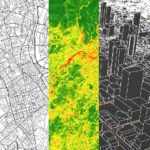
- GeoTIFF: GeoTIFF is a georeferenced version of the TIFF (Tagged Image File Format) standard. It allows for the storage of raster data along with spatial reference information, such as coordinate systems and map projections. GeoTIFFs are commonly used for storing satellite imagery, aerial photographs, and other raster datasets.
- Esri Grid: Esri Grid is a raster GIS file format developed by Esri. It consists of a binary file representing raster data and optional auxiliary files for metadata and spatial referencing. Esri Grid is commonly used for storing elevation data, land cover information, and other continuous raster datasets.
In conclusion, understanding the different GIS data formats is essential for effectively managing and analyzing spatial data. Each format has its strengths and weaknesses, and the choice of format often depends on the specific requirements of the project. By familiarizing yourself with these top seven GIS data formats, you’ll be better equipped to work with spatial data in a variety of contexts.