
Data
How To Download OpenStreetMap Data In QGIS For Free
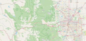
OpenStreetMap (OSM) is a project which can be used to create a freely editable map. These freely available maps can be used for any purpose, maybe personal or commercial purposes.

OpenStreetMap (OSM) is a project which can be used to create a freely editable map. These freely available maps can be used for any purpose, maybe personal or commercial purposes.

Geographic Information Systems (GIS) have become an integral part of modern-day spatial data analysis and visualization. GIS data formats play a crucial role in storing, managing, and exchanging geographical information.

In 2024, Geographic Information Systems (GIS) libraries continue to play a crucial role in transforming how we analyze and visualize spatial data. These libraries empower developers, researchers, and analysts to

In the world of Geographic Information Systems (GIS), 2024 has brought forth a plethora of cutting-edge software options that cater to a wide range of needs and preferences. Whether you’re
We help you become an expert in GIS data handling, processing and analyzing to give a best output.
 Optimized by Seraphinite Accelerator